
Why LiDAR is overhyped for infrastructure monitoring?
In conversation with Dr. Sharvil Alex Faroz
Technology Perspective
Divya Koppikar, Product and UI/UX Designer, Nirixense Technologies
Om Narayan Singh, Applications Engineer, Nirixense Technologies
(July 2026)
Dr. Sharvil Alex Faroz is the Founder of Infrastructure Risk Management (IRM) and a structural engineering expert with a Ph.D. from Indian Institute of Technology Bombay, focused on helping infrastructure owners make better lifecycle decisions.
He is recognized for his work in remaining life assessment, structural health monitoring (SHM), and asset aging management, advancing practical, risk-based approaches to infrastructure resilience and longevity.
Beyond reality capture: Where LiDAR ends and structural intelligence begins
One of the recurring themes in our conversations with infrastructure experts is that no single technology can fully describe the condition of a structure.
LiDAR has rapidly become one of the defining technologies in infrastructure engineering. Improvements in drone-based surveying, mobile mapping, SLAM, AI-assisted point cloud processing, and digital twin platforms have fundamentally changed how physical assets are documented throughout their lifecycle.
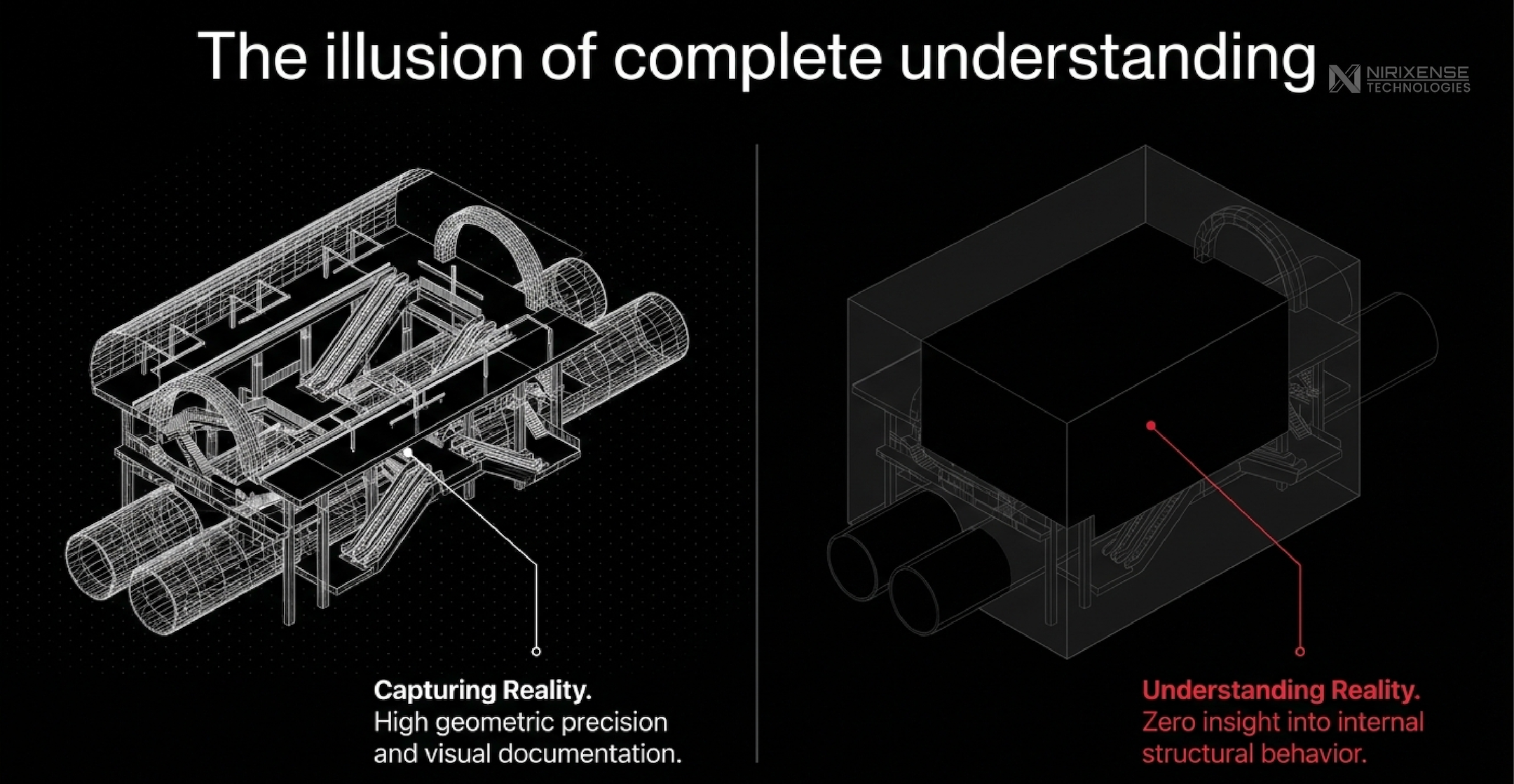
The ecosystem continues to evolve rapidly. Global leaders such as Leica Geosystems, Trimble, Atom Aviation and FARO Technologies continue to improve terrestrial and mobile reality capture, while sensor manufacturers like Luminar Technologies are advancing solid-state LiDAR for higher performance, longer range, and lower deployment costs.
India is witnessing similar momentum. Organizations such as Genesys International are driving large-scale mobile mapping and digital twin initiatives, while companies like Geokno and Garuda Aerospace are expanding drone-based LiDAR across highways, rail corridors, mining, and large civil infrastructure projects.
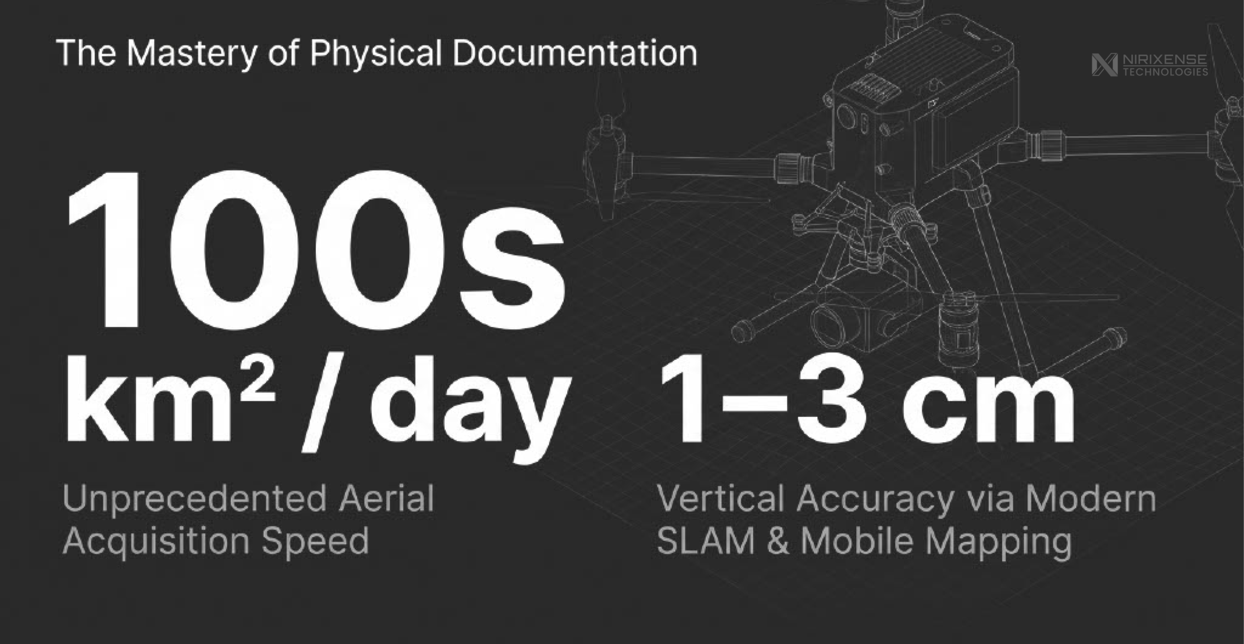
This growth reflects a broader shift in engineering workflows. Depending on terrain, sensor configuration, and flight planning, aerial LiDAR surveys can cover hundreds of square kilometres in a single day, significantly reducing acquisition time compared with conventional ground-based surveying methods. Modern drone and mobile LiDAR systems routinely achieve centimetre-level vertical accuracies (typically 1-3 cm under optimal survey conditions), enabling high-quality Digital Terrain Models (DTMs) for earthwork estimation, corridor design, volumetric analysis, alignment studies, and construction verification.
LiDAR has solved the geometry problem
As Dr. Faroz remarked,
“LiDAR scanning only gives us the geometry.”
That statement is often misunderstood.
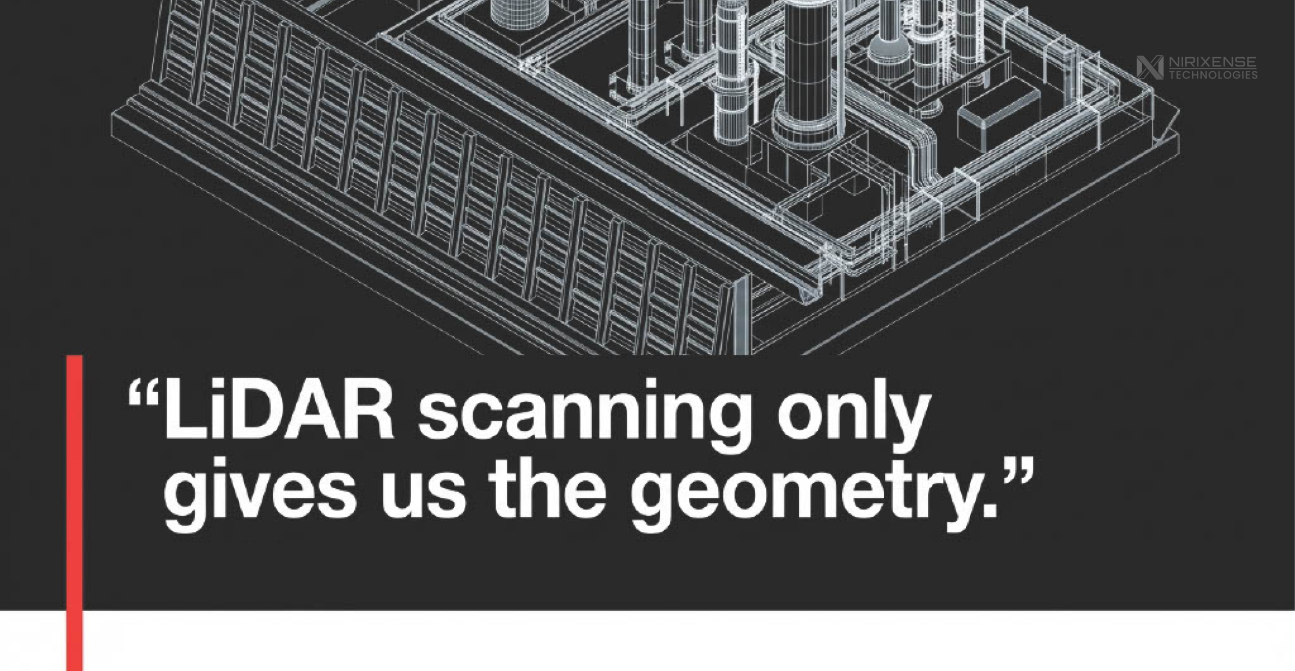
Geometry is precisely what LiDAR is designed to measure, and it does so exceptionally well. High-density point clouds provide an accurate representation of surfaces, elevations, clearances, and physical configurations, enabling engineers to generate reliable topographic models, verify as-built conditions, detect geometric deformation, and create digital twins with unprecedented accuracy.
Over the past decade, the industry has made remarkable progress in solving the challenge of reality capture. The discussion is now beginning to shift beyond how accurately infrastructure can be modelled to what additional information those models need to support engineering decisions.
Infrastructure performance is more than geometry
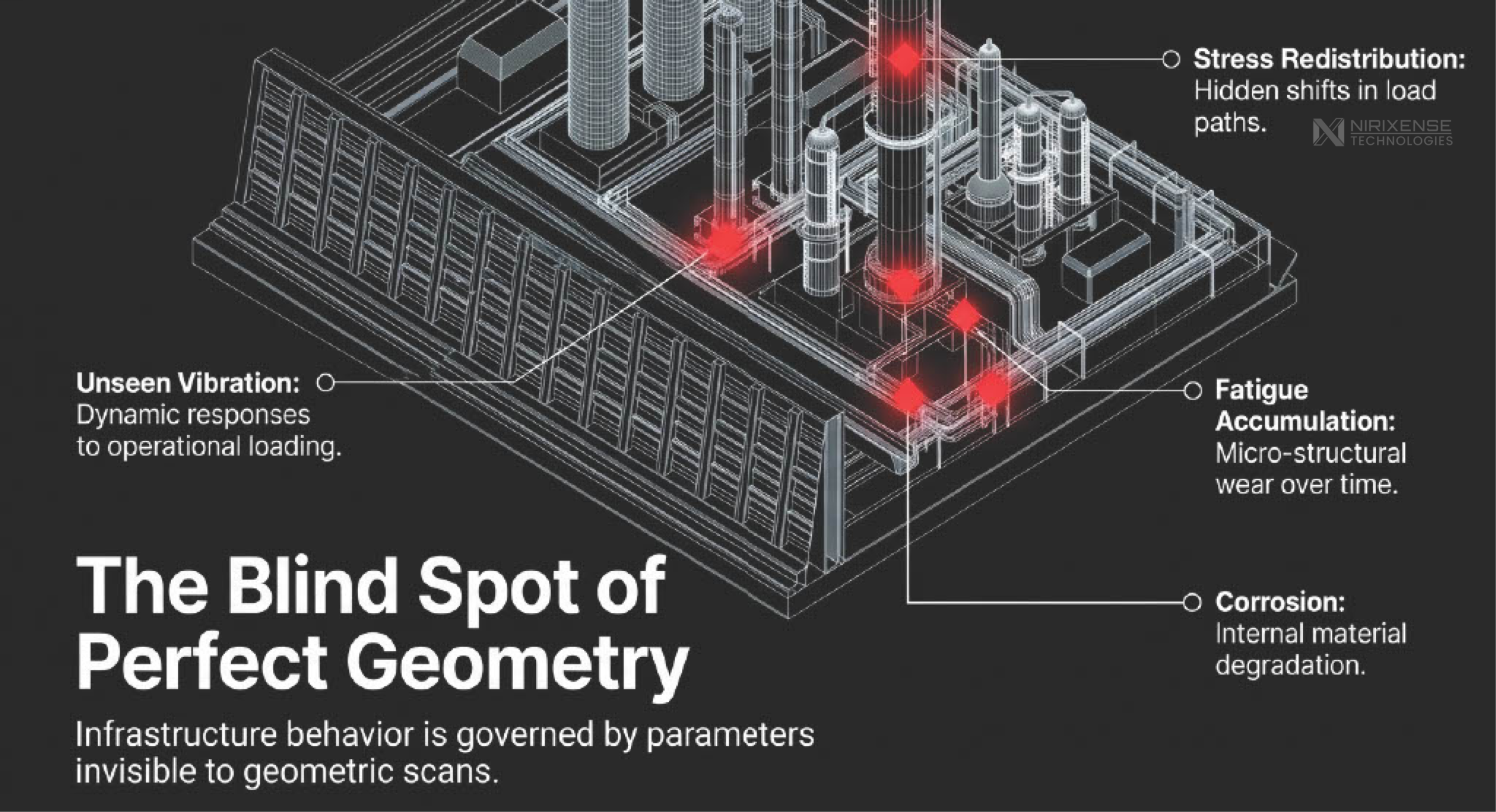
Infrastructure behaviour is governed by parameters that are not always reflected in geometric change.
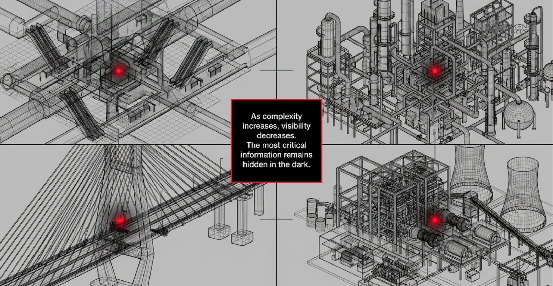
Stress redistribution, fatigue accumulation, corrosion, settlement, vibration, material degradation, and changing load paths often develop before measurable changes appear on the surface. A bridge may retain its geometry while experiencing significant changes in structural response. Likewise, industrial facilities, tunnels, and retaining structures can exhibit progressive deterioration without obvious visual indicators.
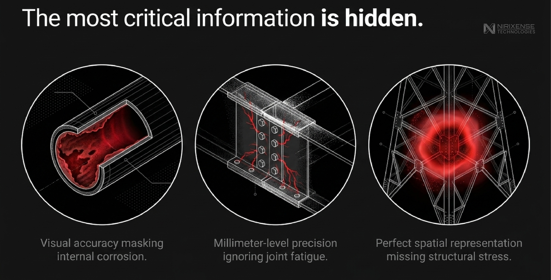
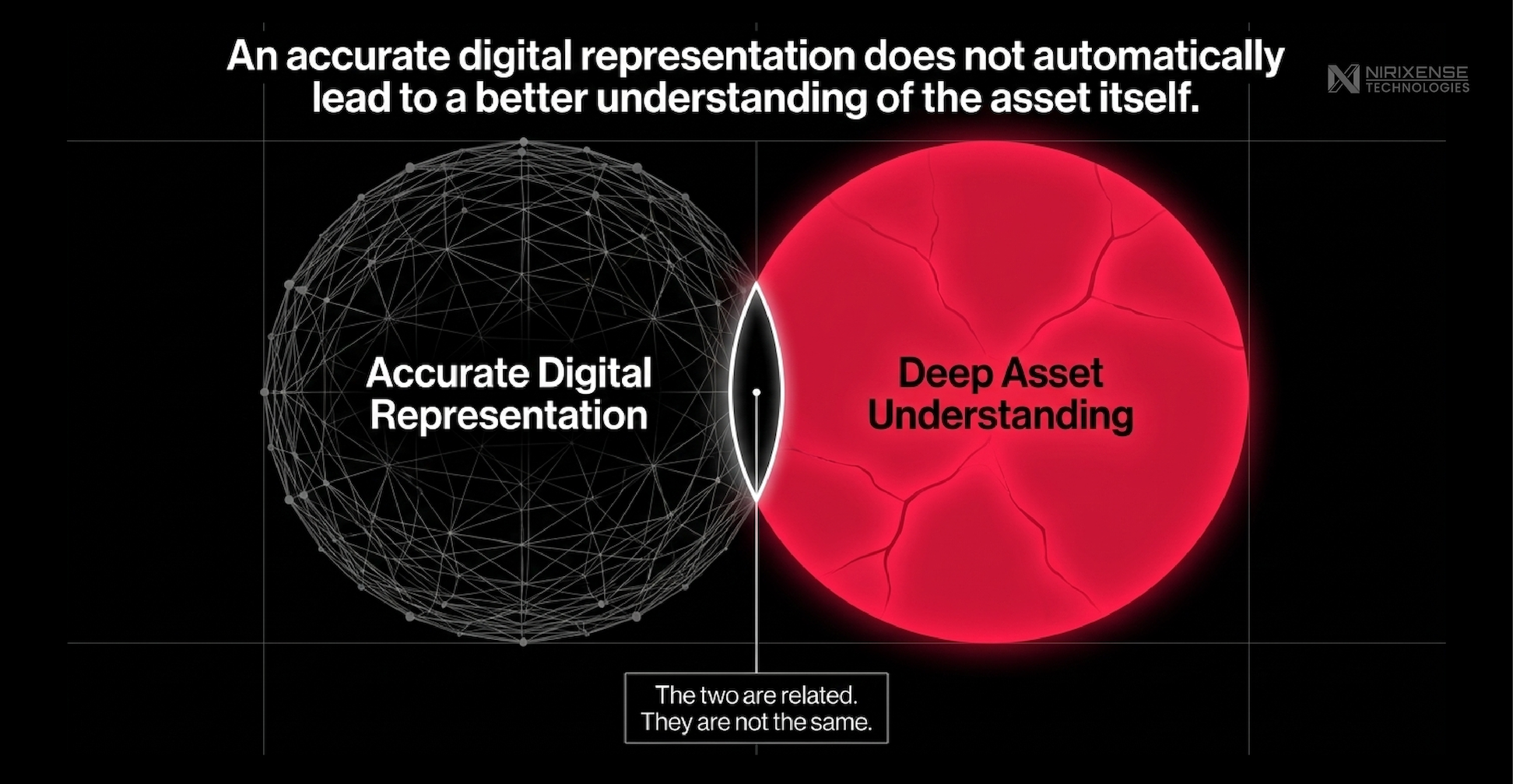
This distinction becomes increasingly important as infrastructure owners move from documentation toward lifecycle management. Accurate geometry provides context, but assessing structural condition requires understanding how an asset behaves under operational and environmental loading.
The next generation of digital twins
LiDAR has become one of the primary enablers of digital twins, providing the spatial framework upon which virtual representations of infrastructure are built.
However, a digital twin becomes substantially more valuable when geometric information is combined with behavioural data. Structural Health Monitoring, inspection records, environmental sensing, and engineering analysis provide context that cannot be derived from point clouds alone.
Rather than asking “What does the structure look like?,” asset owners are increasingly asking:
- How is the structure responding to traffic?
- Has its dynamic behaviour changed?
- Are deterioration mechanisms accelerating?
- Which assets require intervention first?
These are questions that require multiple data layers working together.
An opportunity for the infrastructure technology ecosystem
One of the most interesting outcomes of our discussion with Dr. Faroz was that this should not be viewed as a comparison between LiDAR and Structural Health Monitoring.
They solve different engineering problems.
LiDAR provides the geometric foundation.
SHM provides continuous behavioural information.
Inspection validates observations.
Engineering analysis explains structural response.
Together, they create a far richer understanding of infrastructure than any single technology can achieve independently.
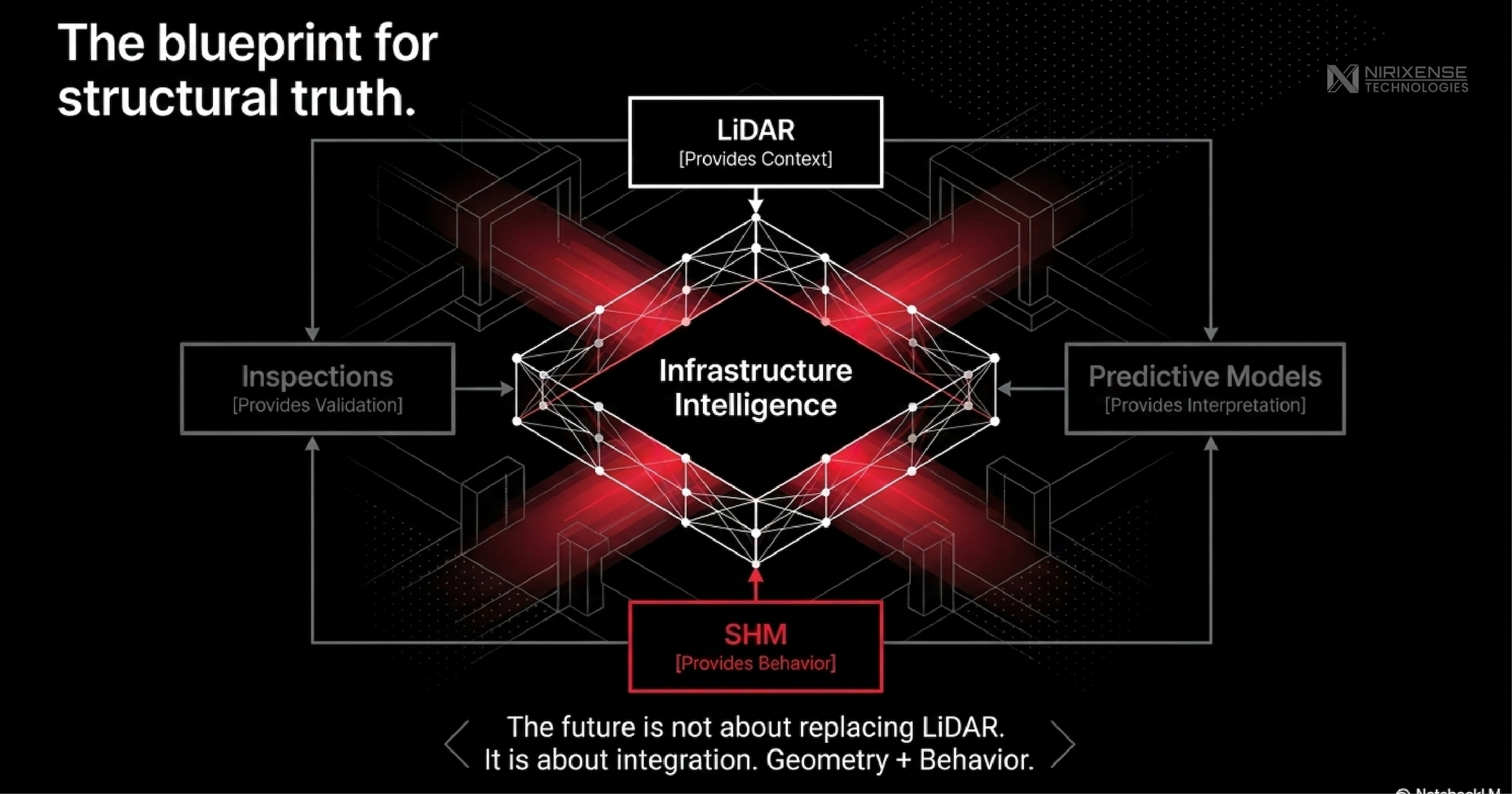
As LiDAR adoption accelerates across infrastructure, there is a growing opportunity for collaboration between geospatial companies, LiDAR manufacturers, digital twin platforms, and structural monitoring providers. Integrating these complementary technologies has the potential to transform digital twins from static geometric models into continuously evolving decision-support systems.
What we’re building at Nirixense
At Nirixense, this conversation closely aligns with our vision for infrastructure intelligence.
Our focus is not on replacing existing geospatial workflows, but on complementing them. We are building Structural Health Monitoring systems that capture continuous behavioural information, including vibration, strain, displacement, tilt, and environmental conditions and integrate these datasets into a unified monitoring framework.
As LiDAR continues to redefine how infrastructure is captured, we believe behavioural intelligence will redefine how infrastructure is understood.
The future of infrastructure monitoring will not be built around a single sensing technology. It will emerge from integrating geometry, structural behaviour, inspection, and engineering analytics into one connected ecosystem.
That was one of the strongest takeaways from our conversation with Dr. Faroz and it’s the direction we’re building towards at Nirixense.
© 2026 Nirixense Technologies Pvt. Ltd. All rights reserved. email: connect@nirixense.com
About this series: Field Notes in Structural Intelligence is a thought leadership series by Nirixense Technologies, where we engage with experts across structural engineering and monitoring to understand how SHM actually works in practice and where it needs to evolve next.